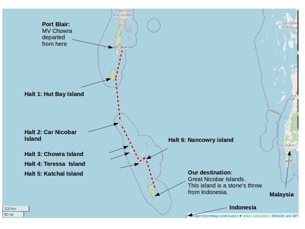
On board MV Chowra: A sea voyage (5/5)
Part 1/5: Beginning of our sea voyage
Part 2/5: The beautiful island of Car Nicobar
Part 3/5: My only complaint about the ship journey
Part 4/5: Remote islands of Chowra and Teressa
We are now almost at the end of our 3.5 days sea journey. Oh and the year is 2017 🙂
Reaching Campbell Bay via Katchal and Nancowry
Katchal was the next stop. We reached Katchal on the same day as Chowra and Teressa. It was lunch time by the time we reached Katchal. We had a two hour halt at Katchal. It was here where we saw the most disastrous effect of the 2004 tsunami.
Background: In 2004, an earthquake measuring 9.3 on the Richter scale occurred along Northern Sumatra, that triggered one of the worst Tsunamis experienced by humankind. The earthquake and tsunami affected over 20 lakh people across 12 countries with over 1.75 lakh deaths with Indonesia being the worst affected. In India, one of the worst affected areas were the remote islands of Andamans and Nicobar. Of these, Katchal was reported to be the worse affected.
We spoke with a policeman who was posted there and who was also keeping an eye on us, so that we do not leave the port area. According to him, among all the islands at Andamans and Nicobars, Katchal apparently was the worst hit with maximum missing persons due to tsunami.
The tsunami had truly devastated the Islands. The most shocking news was that the school was located right at the shore and it was completely destroyed and almost all teachers lost their lives there, according to the police. Incidentally, one WHO Report says that the Tsunami of 2004 damaged at least 68 schools in the Andaman and Nicobar Islands [4].
(Children had not reached the school yet as it was early hours). Even typing this sends chills down my spine. Maximum missing people were from this island, he said.
I cannot even fathom the kind of devastation that the residents might have faced during the Tsunami. And trust me, when you see what you are surrounded by there (its just water till as far as your eyes can see), you will realise the remoteness of this place and the shocking effects of the 2004 tsunami. The only thing people could do was run inland and climb trees. According to the police, most bodies were not recovered at all on this island.
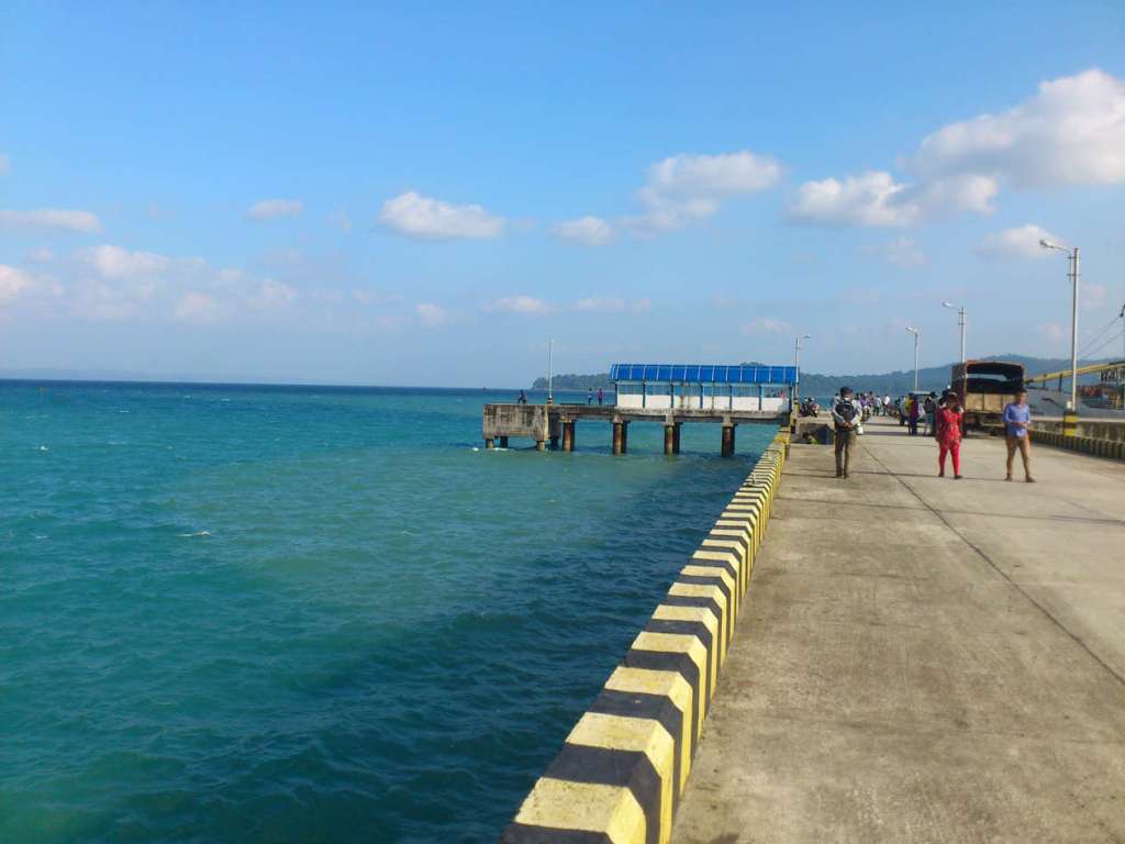
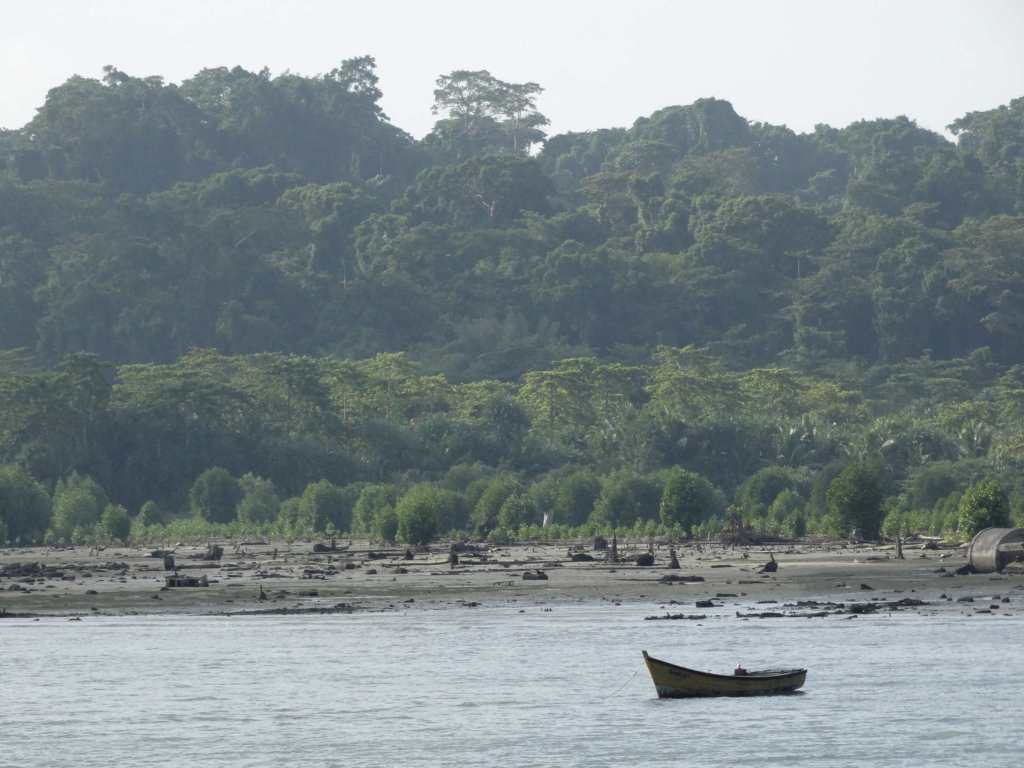
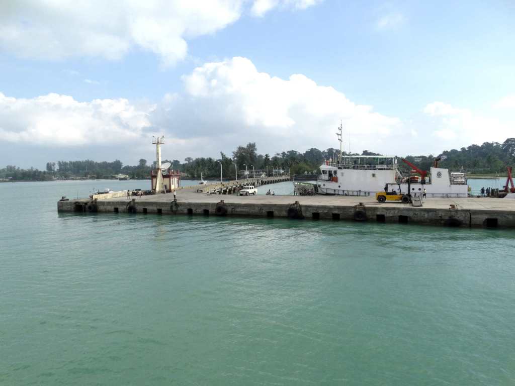
In pre-tsunami days, many of Katchal’s dealings were at the shore: shops, school, homes. But after the tsunami, all the settlements moved 6kms inside. The jetty area where we walked was just a 100 metres from where local buses plied the residents.
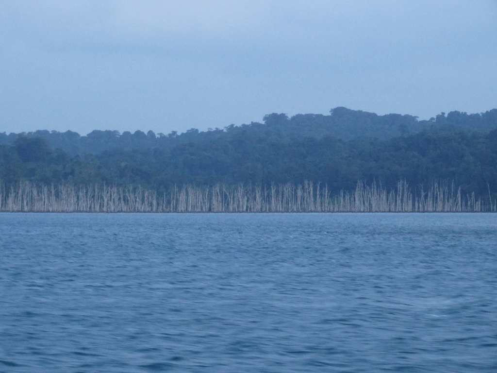
The one hour we spent on the island brought in a rush of emotions. Though we did see the eroded lands on other islands, the scenes here were more striking. Reports suggest that the Nicobar Islands lost over 90% of its mangrove cover in the Tsunami [2][3].
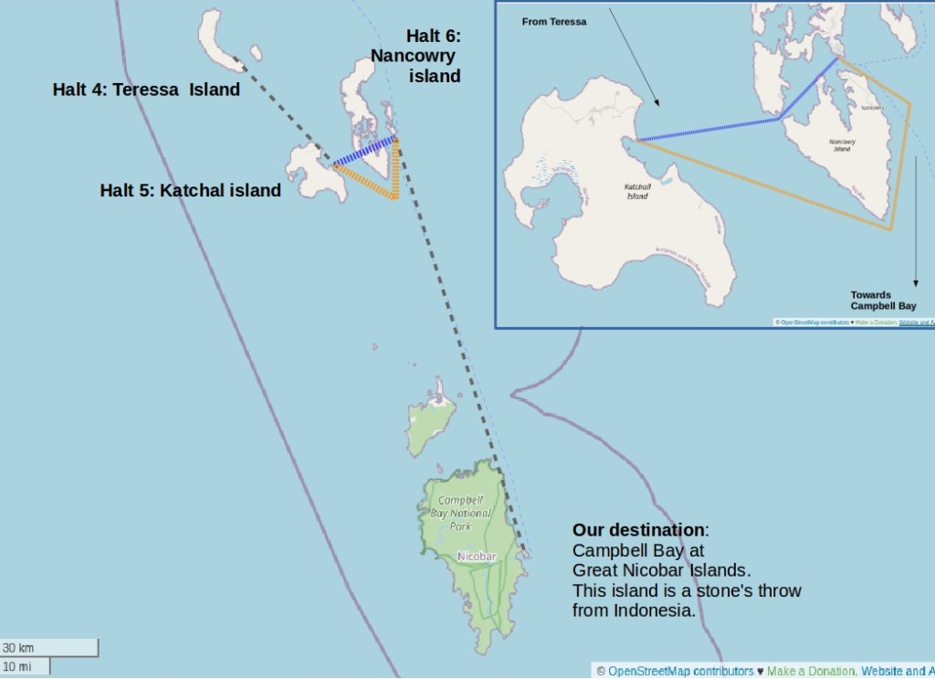
We boarded the ship and headed for Nancowry. It was an island that was very close by. According to the ship mates, if the sea was not too rough, we could make it through a narrow gap between the Nancowry-Kamorta islands (blue line in the image below) and reach the Nancowry port. But if the weather was against us, then we would have to take a longer route (orange line in the image below) and reach Nancowry, two hours later. Fortunately, luck was on our side.
A scheduled stop was made at Nancowry, where we were permitted to have dinner in an eatery just near the port area. Our original identity cards were taken by the police. After a dinner of dosas at a Tamilian’s shop, we made our way back to the ship and sailed to our final destination. We spent yet another night on the ship. Next morning, we reach the beautiful township of Campbell Bay, of the Great Nicobar Island.
Over the last 3 days, we travelled in the vast expanse of the Indian Ocean passing through some of the most remote locations in the world. Oh and I did not get seasick at all!
In fact, in this journey, I have not mentioned about the Narcondam Island, Barren Island, North Sentinel Island, all of which are unique for certain geographical, environmental and cultural factors! For example, Narcondam island is home to the endemic and endangered Narcondam hornbill bird! Barren Island harbours India’s only active volcano! And the North Sentinel Island is home to one of the world’s most remote, hostile and secretive tribe, the Sentinelese!
I will write about Campbell bay and its people in another post. Till then, I hope you enjoyed the journey with me onboard MV Chowra!
Thanks to Ashwin Mohan for his inputs.
Further reading:
Short Stories Trip Reports adventurous andamanandnicobarislands barren biodiversityhotspot campbellbay coastalislands destination destruction earthlynotes earthquake ecological ecologicalhabitat ecotourism endemicspecies friendships habitatdestruction indianforests indiantourist indianwildilife indiatourism indigenouspeoples indonesia indonesiaearthquake islanders islandlife islands islandtourism jetty journey katchal katchall learnfromlocals localculture localguides localpeople mangroves narcondam nicobar nicobarislands observeandlearn observenature port portblair remoteindia remoteislands remotevillage respectpeopleandplaces routes searoute seasick seatrip seavoyage sentinel ship shiplife ships shiptales shipvoyage theearthlynotes tourism travel travelblogger traveldiaries travelgram travelinIndia travellight travellinginIndia travelphotography travelstories travelsustainably traveltales tribalpeople tribes trips tsunami2004 underwater voyage waves
Earthly Notes View All →
My name is Adithi Muralidhar. I am a nature enthusiast based in Mumbai, India.

1 Comment Leave a comment ›